Back مقاطعة رتشلاند (أوهايو) Arabic Richland County, Ohio BAR Ричланд (окръг, Охайо) Bulgarian রিচল্যান্ড কাউন্টি, ওহাইও BPY Richland Gông (Ohio) CDO Richland County (kondado sa Tinipong Bansa, Ohio) CEB Richland County, Ohio Welsh Richland County (Ohio) Danish Richland County (Ohio) German Condado de Richland (Ohio) Spanish
Richland County | |
|---|---|
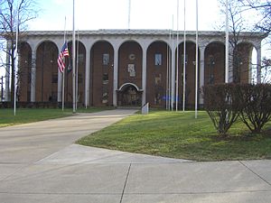
 Richland County Courthouse | |
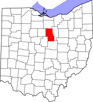
 Location within the U.S. state of Ohio | |
 Ohio's location within the U.S. | |
| Coordinates: 40°47′N 82°32′W / 40.78°N 82.54°W | |
| Country | |
| State | |
| Founded | March 1, 1813 |
| Named for | their fertile soil |
| Seat | Mansfield |
| Largest city | Mansfield |
| Area | |
| • Total | 500 sq mi (1,000 km2) |
| • Land | 495 sq mi (1,280 km2) |
| • Water | 4.8 sq mi (12 km2) 1.0% |
| Population (2020) | |
| • Total | 124,936 |
| • Density | 250/sq mi (100/km2) |
| Time zone | UTC−5 (Eastern) |
| • Summer (DST) | UTC−4 (EDT) |
| Congressional district | 4th |
| Website | www |
Richland County is a county located in the U.S. state of Ohio. As of the 2020 census, the population was 124,936.[1] Its county seat is Mansfield.[2] The county was created in 1808 and later organized in 1813.[3] It is named for the fertile soil found there.[4] Richland County is included in the Mansfield, OH Metropolitan Statistical Area as well as the Mansfield-Ashland-Bucyrus, OH Combined Statistical Area. The county is one of the six Metropolitan Statistical Areas that make up Northeast Ohio.
- ^ 2020 census
- ^ "Find a County". National Association of Counties. Archived from the original on May 31, 2011. Retrieved June 7, 2011.
- ^ "Ohio: Individual County Chronologies". Ohio Atlas of Historical County Boundaries. The Newberry Library. 2007. Archived from the original on April 6, 2016. Retrieved February 14, 2015.
- ^ "Richland County data". Ohio State University Extension Data Center. Retrieved April 28, 2007.[dead link]

