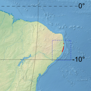
| Rio Piranhas mangroves | |
|---|---|
 | |
 Ecoregion territory (in purple) | |
| Ecology | |
| Realm | Neotropic |
| Biome | Mangroves |
| Geography | |
| Area | 2,072 km2 (800 sq mi) |
| Country | Brazil |
The Rio Piranhas mangroves ecoregion (WWF ID: NT1432) covers a series of mangrove forests along the Atlantic Ocean coast of the eastern tip of Brazil. The mangrove sections are spread across 350 km, from the mouth of the Mamanguape River in the north, to the vicinity of Maceió in the south. This coast is centered on the city of Recife, and the mangrove sections often surround industrial ports and cities.[1][2][3]
- ^ "Rio Piranhas mangroves". World Wildlife Federation. Retrieved December 14, 2020.
- ^ "Map of Ecoregions 2017". Resolve, using WWF data. Retrieved December 14, 2020.
- ^ "Rio Piranhas mangroves". The Encyclopedia of Earth. Retrieved December 14, 2020.
