| River Seph | |
|---|---|
 Footbridge over the River Seph | |
| Etymology | Slow Stream |
| Physical characteristics | |
| Source | |
| • location | Chop Gate |
| • coordinates | 54°23′10″N 1°08′27″W / 54.386121°N 1.140853°W |
| • elevation | 520 feet (160 m) |
| Mouth | Seph Mouth |
• coordinates | 54°17′28″N 1°08′46″W / 54.291175°N 1.146138°W |
| Length | 13 miles (20.5 km) |
| Basin features | |
| Tributaries | |
| • left | Ledge Beck Todhill Beck |
| • right | Hollow Bottom Beck Fangdale Beck |
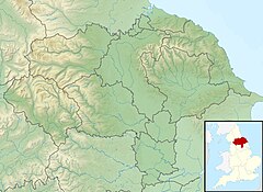
The River Seph (or River Sep) is a tributary of the River Rye (itself a tributary of the River Derwent) in North Yorkshire, England.[1] The river flows for 13 miles (20.5 km) down Bilsdale and meets the Rye near the village of Hawnby.[2] When the surrounding land was owned by Roger de Mowbray, the river was referred to as the Sep.[3]
- ^ "River Factfiles; The Derwent Catchment" (PDF). ea-lit.freshwaterlife.org. Environment Agency. p. 2. Retrieved 4 November 2018.
- ^ "BILSDALE VALLEY: WALKING with Rodger Matthews". Hull Daily Mail. 21 July 2012. ProQuest 1027225602.
- ^ Farrer, William, ed. (2013). Early Yorkshire Charters : Being a Collection of Documents Anterior to the Thirteenth Century Made from the Public Records, Monastic Chartularies, Roger Dodsworth's Manuscripts and Other Available Sources. Volume 3 (Digital ed.). Cambridge: Cambridge University Press. p. 453. ISBN 978-1-108-05825-4.

