Back Rominten meşəsi Azerbaijani Puszcza Romincka CEB Puszcza Romincka Danish Rominter Heide German Δάσος Ρόμινσκα Greek جنگل رومینکا Persian Romintos giria Lithuanian Rominckaskogen NN Rominckaskogen NB Puszcza Romincka Polish
This article needs additional citations for verification. (December 2016) |
| Romincka Forest | |
|---|---|
 Romincka Forest | |
| Map | |
| Geography | |
| Location | Poland, Russia |
| Coordinates | 54°22′18″N 22°31′17″E / 54.37167°N 22.52139°E |
| Area | 250 km2 (100 sq mi) |
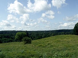
Romincka Forest (Polish: Puszcza Romincka, Lithuanian: Romintos giria), also known as Krasny Les (Russian: Красный лес) or Rominte Heath (German: Rominter Heide), is an extended forest and heath landscape stretching from the southeast of Russian Kaliningrad Oblast to the northeast of Polish Warmian-Masurian Voivodeship.
