Kelvington No. 366 | |
|---|---|
| Rural Municipality of Kelvington No. 366 | |
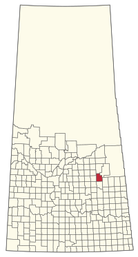
 Location of the RM of Kelvington No. 366 in Saskatchewan | |
| Coordinates: 52°20′02″N 103°37′34″W / 52.334°N 103.626°W[1] | |
| Country | Canada |
| Province | Saskatchewan |
| Census division | 14 |
| SARM division | 4 |
| Formed[2] | January 1, 1913 |
| Government | |
| • Reeve | Maurice Patenaude |
| • Governing body | RM of Kelvington No. 366 Council |
| • Administrator | Heather Elmy |
| • Office location | Kelvington |
| Area (2016)[4] | |
| • Land | 862.24 km2 (332.91 sq mi) |
| Population (2016)[4] | |
| • Total | 398 |
| • Density | 0.5/km2 (1/sq mi) |
| Time zone | CST |
| • Summer (DST) | CST |
| Area code(s) | 306 and 639 |
The Rural Municipality of Kelvington No. 366 (2016 population: 398) is a rural municipality (RM) in the Canadian province of Saskatchewan within Census Division No. 14 and SARM Division No. 4. It is located in the southeast portion of the province.
- ^ "Pre-packaged CSV files - CGN, Canada/Province/Territory (cgn_sk_csv_eng.zip)". Government of Canada. July 24, 2019. Retrieved May 23, 2020.
- ^ Cite error: The named reference
ruralincorpwas invoked but never defined (see the help page). - ^ "Municipality Details: RM of Kelvington No. 366". Government of Saskatchewan. Retrieved May 21, 2020.
- ^ a b Cite error: The named reference
2016censusSKmuniswas invoked but never defined (see the help page).
