Back نهر سانت تشارلز (نهر فى كندا) ARZ Rivière Saint-Charles (luuk) CEB Rivière Saint-Charles (Valleyfield) French Rivière Saint-Charles (vik) Swedish
| Saint Charles River | |
|---|---|
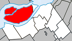
 Map of the Rivière Saint-Charles/Salaberry-de-Valleyfield | |
| Native name | Rivière Saint-Charles (French) |
| Location | |
| Country | Canada |
| Province | Quebec |
| Physical characteristics | |
| Source | |
| • location | Lake Saint Francis |
| • coordinates | 45°15′20″N 74°09′05″W / 45.25556°N 74.15139°W |
| • elevation | 250 m (820 ft) |
| Mouth | |
• location | Lake Saint-Louis |
• coordinates | 45°17′36″N 74°02′20″W / 45.29333°N 74.03889°W |
| Length | 25 km (15.5 mi) |
| Discharge | |
| • average | 30 m3/s (1,059.44 cu ft/s) |
The Saint Charles River (French: Rivière Saint-Charles) is a branch of the Saint Lawrence River that starts in Salaberry-de-Valleyfield, Quebec, Canada. The river divides the Grande-Île and the Island of Salaberry, which are located approximately 50 km east of Montreal. The river is 8 km long, and drops 24m over its course from Lake Saint Francis east to Lake Saint-Louis.