| Sanpoil River | |
|---|---|
 | |
 | |
| Location | |
| Country | United States |
| Region | Okanagan Highlands |
| State | Washington |
| Counties | Ferry and Okanogan County |
| Towns | Republic and Keller |
| Physical characteristics | |
| Source | Copper Butte |
| • location | 48°42′09″N 118°27′56″W / 48.7025°N 118.4656°W |
| • coordinates | 48°38′54″N 118°38′12″W / 48.64833°N 118.63667°W[2] |
| • elevation | 7,135 ft (2,175 m)[1] |
| Mouth | Sanpoil Arm, Columbia River |
• coordinates | 47°56′55″N 118°40′50″W / 47.94861°N 118.68056°W[2] |
• elevation | 1,293 ft (394 m)[3] |
| Length | 59 mi (95 km)[1] |
| Basin size | 981 sq mi (2,540 km2)[1] |
| Discharge | |
| • location | mouth, Sanpoil Arm, mile 615.5 Lake Roosevelt |
| Basin features | |
| Tributaries | |
| • left | Dick Creek, John Tom Creek, Silver Creek, Copper Creek, Alice Creek, Cow Creek, Iron Creek, Louie Creek, Bridge Creek, Thirtymile Creek, Deadhorse Creek, Twentyfive Mile Creek, Twentythree Mile Creek, Twentyonemile Creek, Seventeenmile Creek, Thirteenmile Creek, Ninemile Creek, Mcmann Creek, Camel Creek, O'Brian Creek |
| • right | Manilla Creek, Meadow Creek, Jack Creek, Brush Creek. Empire Creek, Lime Creek, Cache Creek, McAllister Creek, Capoose Creek, Cub Creek, South Nanamkin Creek, North Nanamkin Creek, Bear Creek, Anderson Creek, Nineteenmile Creek, West Fork Sanpoil River, Tenmile Creek, Sunset Creek, Gold Creek, Scatter Creek, Golden Harvest Creek, Granite Creek |
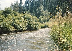
The Sanpoil River (also spelled San Poil) is a tributary of the Columbia River, in the U.S. state of Washington. The river is named for the Sanpoil, the Interior Salish people who live along the river course. The name is from the Okanagan term [snpʕʷílx], meaning "people of the gray country", or "gray as far as one can see".
