Saroornagar | |
|---|---|
| Coordinates: 17°21′22″N 78°32′00″E / 17.3561°N 78.5333°E | |
| Country | |
| State | Telangana |
| City | Hyderabad |
| Elevation | 487 m (1,598 ft) |
| Population (2011)[1] | |
| • Total | 69,400 |
| Languages | |
| • Official | Telugu, Urdu |
| Time zone | UTC+5:30 (IST) |
| PIN | 500 035 |
| Telephone code | +91 , 040 |
| Vehicle registration | TS |
Saroornagar is a neighbourhood in Hyderabad. It is located in the Rangareddy district of Indian state of Telangana. It is located in Saroornagar mandal of Kandukur revenue division.

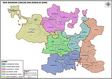
[2] This circle (5) comes under L. B. Nagar (East Zone) of Greater Hyderabad Municipal Corporation.[3] There are five wards in this circle namely Saroornagar (19), Rama Krishna Puram (20), Kothapet (21), Chaitanyapuri (22) and Gaddiannaram (23).
- ^ "Delimitation of Election Wards" (PDF). Greater Hyderabad Municipal Corporation. Archived from the original (PDF) on 10 November 2011. Retrieved 12 June 2017.
- ^ "Rangareddy district" (PDF). New Districts Formation Portal. Government of Telangana. Archived from the original (PDF) on 13 October 2016. Retrieved 26 March 2017.
- ^ "New circles and wards in GHMC". Greater Hyderabad Municipal Corporation (JPG). Archived from the original on 18 August 2018. Retrieved 13 June 2023.


