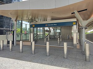
Shenton Way | |
|---|---|
Road | |
 | |
 Location in Singapore | |
| Coordinates: 1°16′40″N 103°51′02″E / 1.2778°N 103.8505°E | |
| Country | |
| Planning Area | Central Area |
| Boundaries | Boon Tat Street, Raffles Quay, Commerce Street and Keppel Road |
Shenton Way is a major trunk road serving Singapore's Central Area and is most commonly known for the commercial skyscrapers flanking both sides of the road. The road is a one-way street that starts at the junction of Boon Tat Street, Raffles Quay and Commerce Street before ending at Keppel Road.

