| Shire of Ballarat Victoria | |||||||||||||||
|---|---|---|---|---|---|---|---|---|---|---|---|---|---|---|---|
 Location in Victoria | |||||||||||||||
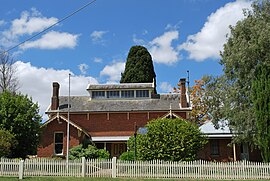
 Historic shire office at Learmonth | |||||||||||||||
| Population | 19,530 (1992)[1] | ||||||||||||||
| • Density | 40.541/km2 (105.000/sq mi) | ||||||||||||||
| Established | 1856 | ||||||||||||||
| Area | 481.74 km2 (186.0 sq mi) | ||||||||||||||
| Council seat | Wendouree | ||||||||||||||
| Region | Grampians | ||||||||||||||
| County | Ripon, Talbot, Grenville | ||||||||||||||
 | |||||||||||||||
The Shire of Ballarat was a local government area immediately to the northwest and west of the regional city of Ballarat, Victoria, Australia. The shire covered an area of 481.74 square kilometres (186.0 sq mi), and existed from 1856 until 1994.
