| Shropshire Hills National Landscape | |
|---|---|
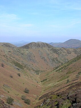
 Townbrook Valley in the Long Mynd. | |
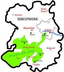
 Location of the Shropshire Hills AONB in England | |
| Location | Shropshire, England |
| Area | 802 km2 (310 sq mi) |
| Established | 1958 |
| Governing body | Shropshire Hills AONB Partnership |
| Website | www.shropshirehillsaonb.co.uk |

The Shropshire Hills National Landscape is a designated Area of Outstanding Natural Beauty (AONB) in Shropshire, England. It is located in the south of the county, extending to its border with Wales. Designated in 1958,[1] the area encompasses 802 square kilometres (310 sq mi) of land primarily in south-west Shropshire, taking its name from the upland region of the Shropshire Hills. The A49 road and Welsh Marches Railway Line bisect the area north–south, passing through or near Shrewsbury, Church Stretton, Craven Arms and Ludlow.

- ^ "Archived copy". Archived from the original on 27 September 2007. Retrieved 14 May 2007.
{{cite web}}: CS1 maint: archived copy as title (link)
