Back Souris (lungsod sa Manitoba) CEB سوریس، منیتوبا Persian Souris (Manitoba) French Сурис (Манитоба) Serbian Souris, Manitoba Swedish
Souris | |
|---|---|
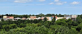
From top, left to right: A view of the Souris skyline from Victoria Park, historic buildings on Crescent Avenue, Hillcrest Museum, the Souris River, and grain elevators in Souris. | |
| Coordinates: 49°37′02″N 100°15′37″W / 49.61722°N 100.26028°W[1] | |
| Country | Canada |
| Province | Manitoba |
| Municipality | Souris-Glenwood |
| Established | 1881 |
| Incorporated | 1903 |
| Amalgamation | 2015 |
| Government | |
| • MLA | Grant Jackson (PC) |
| • MP | Larry Maguire (CPC) |
| Area (2021)[2] | |
| • Land | 3.35 km2 (1.29 sq mi) |
| • Population centre | 2.5 km2 (1.0 sq mi) |
| • Census subdivision (Souris-Glenwood) | 579.69 km2 (223.82 sq mi) |
| Elevation (at weather station)[3] | 432.8 m (1,419.9 ft) |
| Population | |
| • Total | 1,970 |
| • Density | 588.7/km2 (1,525/sq mi) |
| • Population centre | 1,935 |
| • Population centre density | 772.6/km2 (2,001/sq mi) |
| • Census subdivision | 2,547 |
| • Census subdivision density | 4.4/km2 (11/sq mi) |
| Demonym | Sourisites |
| Time zone | UTC−06:00 (CST) |
| • Summer (DST) | UTC−05:00 (CDT) |
| Postal code | |
| Area code(s) | 204 |
| Website | www |
Souris (2021 population: 1,970[2]) is an unincorporated urban community in the Municipality of Souris-Glenwood within the Canadian province of Manitoba that held town status prior to the Manitoba municipal amalgamations on January 1, 2015. It is located within the municipality at the confluence of Plum Creek and Souris River, from which it takes its name. Before 1882, the town was called Plum Creek.[4]
The community is home to Canada's longest historic cable-stayed footbridge at 177 m (581 ft) long,[5] known as the Swinging Bridge, which spans the Souris River that divides the community. The Swinging Bridge was built in 1904 as a means of transportation over the Souris River, later floods destroyed the original swinging bridge and in 2013 a modern cable bridge was installed.[6]
- ^ "Souris". Geographical Names Data Base. Natural Resources Canada.
- ^ a b c Cite error: The named reference
statCAN2021was invoked but never defined (see the help page). - ^ Cite error: The named reference
envcanwas invoked but never defined (see the help page). - ^ Hamilton, William (1978). The Macmillan Book of Canadian Place Names. Toronto: Macmillan. p. 65. ISBN 0-7715-9754-1.
- ^ Encyclopedia of Manitoba (Winnipeg: Great Plains Publications, 2007), p. 648.
- ^ "Manitoba town cuts historic footbridge to save dike". CTVNews. July 3, 2011.


