Back سلسلة جبال الطيف Arabic سلسلة جبال الطيف ARZ Spectrum Range CEB Spectrum-hegység Hungarian Spectrum Range Swedish
| Spectrum Range | |
|---|---|
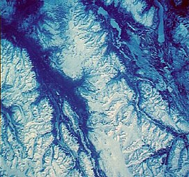
 Satellite photo of the Spectrum Range | |
| Highest point | |
| Peak | Kitsu Peak |
| Elevation | 2,414 m (7,920 ft) |
| Coordinates | 57°26′0″N 130°41′0″W / 57.43333°N 130.68333°W |
| Geography | |
| Country | Canada |
| Province | British Columbia |
| Parent range | Tahltan Highland (southwestern Stikine Plateau) |
| Geology | |
| Orogeny | Volcanism |
| Age of rock | Pliocene-to-Holocene |
| Type of rock | Shield volcano |
The Spectrum Range, formerly called the Spectrum Mountains and the Rainbow Mountains, is a subrange of the Tahltan Highland in the Stikine Country of northwestern British Columbia, 20 km west of the Stewart-Cassiar Highway, south of Mount Edziza and north of the Arctic Lake Plateau. The Spectrum Range falls within Mount Edziza Provincial Park. The range is lightly glaciated, as compared to the other ranges to the west. It is accessible only by foot or via helicopter; there are no roads to the range.[1]
- ^ Scheffel, Richard L.; Wernet, Susan J., eds. (1980). Natural Wonders of the World. United States of America: Reader's Digest Association, Inc. pp. 354. ISBN 0-89577-087-3.
