Back ستاركفيل Arabic ستاركفيل ARZ استارکویل، میسیسیپی AZB Старквил Bulgarian Starkville (Mississipi) Catalan Старквилл (Миссисипи) CE Starkville CEB Starkville, Mississippi Welsh Starkville DAG Starkville (Mississippi) German
Starkville, Mississippi | |
|---|---|
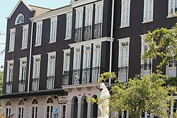
 Cotton District | |
| Nickname(s): | |
 Location of Starkville, Mississippi | |
| Coordinates: 33°27′45″N 88°49′12″W / 33.46250°N 88.82000°W | |
| Country | |
| State | |
| County | Oktibbeha |
| City | 1835 |
| Named for | John Stark |
| Government | |
| • Type | Mayor-Council government |
| • Mayor | Lynn Spruill (D)[3] |
| Area | |
| • Total | 25.62 sq mi (66.37 km2) |
| • Land | 25.51 sq mi (66.08 km2) |
| • Water | 0.11 sq mi (0.28 km2) |
| Elevation | 335 ft (102 m) |
| Population (2020) | |
| • Total | 24,360 |
| • Density | 954.77/sq mi (368.63/km2) |
| Time zone | UTC−6 (Central (CST)) |
| • Summer (DST) | UTC−5 (CDT) |
| ZIP codes | 39759-39760 |
| Area code | 662 |
| FIPS code | 28-70240 |
| GNIS feature ID | 0678227 |
| Website | City of Starkville |
Starkville is a city in, and the county seat of, Oktibbeha County, Mississippi, United States. As of the 2020 United States census, Starkville's population is 24,360, making it the 16th-most populated city in Mississippi.[5] Starkville is the largest city in the Golden Triangle, which had a population of 175,474 in 2020, and the principal city of the Starkville-Columbus, MS CSA. Founded in 1831, the city was originally known as Boardtown for the local sawmilling operation there, but was renamed in 1837 to honor American Revolutionary War general John Stark.[6]
Starkville is adjacent to and closely associated with Mississippi State University, which was founded as the state's flagship land-grant research university in 1878. The university was located near Starkville in the Mississippi Black Belt due to the region's agricultural productivity, particularly in the timber, cattle, and dairying industries. The expansion of the university transformed Starkville from a primarily agricultural center into a college town, and its economy today is mostly centered around advanced research and manufacturing, retail, and tourism supported by the university population. The Cotton District, developed in the 1960s as North America's first New Urbanist community, is an active student quarter located between downtown Starkville and the university campus.[7]
- ^ Low, Chris (August 15, 2008). "Welcome to Stark-Vegas". ESPN College Football. ESPN. Retrieved June 27, 2014.
- ^ "What's in a name?" (PDF). Msucares.com. Archived (PDF) from the original on December 3, 2008. Retrieved December 5, 2015.
- ^ "Starkville, MS - Official Website". Cityofstarkville.org. Retrieved December 27, 2017.
- ^ "2020 U.S. Gazetteer Files". United States Census Bureau. Retrieved July 24, 2022.
- ^ "Explore Census Data". data.census.gov. Retrieved July 2, 2024.
- ^ "Starkville | College Town, Home of MSU | Britannica". www.britannica.com. Retrieved July 2, 2024.
- ^ "The Town Paper: New Towns – Cotton District, Mississippi". www.tndtownpaper.com. Retrieved June 12, 2018.


