Back ستوكسدال (كارولاينا الشمالية) Arabic Stokesdale Catalan Стоксдейл (Къилбаседа Каролина) CE Stokesdale CEB Stokesdale (Carolina del Norte) Spanish Stokesdale (Ipar Carolina) Basque استوکسدال، کارولینای شمالی Persian Stokesdale (Caroline du Nord) French Stokesdale, Kawolin dinò HT Stokesdale Italian
Stokesdale, North Carolina | |
|---|---|
 | |
| Motto(s): | |
 | |
| Coordinates: 36°13′54″N 79°59′00″W / 36.23167°N 79.98333°W | |
| Country | United States |
| State | North Carolina |
| County | Guilford County, Rockingham County, Forsyth County, Stokes County |
| Incorporated | 1907[1] |
| Government | |
| • Type | Mayor-council[2] |
| • Mayor | Mike Crawford[3] |
| Area | |
| • Total | 19.18 sq mi (49.68 km2) |
| • Land | 19.03 sq mi (49.29 km2) |
| • Water | 0.15 sq mi (0.38 km2) |
| Elevation | 935 ft (285 m) |
| Population (2020) | |
| • Total | 5,924 |
| • Density | 311.25/sq mi (120.17/km2) |
| Time zone | UTC-5 (Eastern (EST)) |
| • Summer (DST) | UTC-4 (EDT) |
| ZIP code | 27357 |
| Area code | 336 |
| FIPS code | 37-65040[6] |
| GNIS feature ID | 2406668[5] |
| Website | www.stokesdale.org |
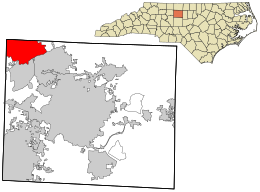
Stokesdale is a town in Guilford County, North Carolina, United States with small parts in the counties of Rockingham, Forsyth, and Stokes. The population was 5,924 at the 2020 census. Belews Lake is located nearby, and North Carolina Highway 68 and North Carolina Highway 65 both intersect U.S. Route 158 near the town's center.
- ^ "North Carolina Gazetteer". Retrieved November 24, 2023.
- ^ "Forms of Government and Methods of Election in North Carolina Cities | UNC School of Government". www.sog.unc.edu. Retrieved January 15, 2024.
- ^ "Welcome To Town Of Stokesdale, NC". www.stokesdale.org. Retrieved January 15, 2024.
- ^ "ArcGIS REST Services Directory". United States Census Bureau. Retrieved September 20, 2022.
- ^ a b U.S. Geological Survey Geographic Names Information System: Stokesdale, North Carolina
- ^ "U.S. Census website". United States Census Bureau. Retrieved January 31, 2008.

