Back স্ট্রয়ন BPY Stryn Catalan Stryn (munisipyo) CEB Stryn Danish Stryn German Stryn Esperanto Stryn Spanish Stryni vald Estonian Stryn Basque Stryn Finnish
Stryn Municipality
Stryn kommune | |
|---|---|
 View of Stryn | |
|
| |
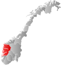
 Vestland within Norway | |
 Stryn within Vestland | |
| Coordinates: 61°50′19″N 06°51′46″E / 61.83861°N 6.86278°E | |
| Country | Norway |
| County | Vestland |
| District | Nordfjord |
| Established | 1843 |
| • Preceded by | Innvik Municipality |
| Administrative centre | Stryn |
| Government | |
| • Mayor (2019) | Per Kjøllesdal (Sp) |
| Area | |
| • Total | 1,382.02 km2 (533.60 sq mi) |
| • Land | 1,325.86 km2 (511.92 sq mi) |
| • Water | 56.16 km2 (21.68 sq mi) 4.1% |
| • Rank | #67 in Norway |
| Population (2023) | |
| • Total | 7,244 |
| • Rank | #140 in Norway |
| • Density | 5.5/km2 (14/sq mi) |
| • Change (10 years) | |
| Demonym | Stryning[1] |
| Official language | |
| • Norwegian form | Nynorsk |
| Time zone | UTC+01:00 (CET) |
| • Summer (DST) | UTC+02:00 (CEST) |
| ISO 3166 code | NO-4651[3] |
| Website | Official website |
Stryn is a municipality in the county of Vestland, Norway. It is located in the traditional district of Nordfjord. The administrative center of the municipality is the village of Stryn. The municipality is located along the innermost part of the Nordfjorden. Some of the main villages in Stryn include Loen, Innvik, Utvik, Randabygda, Olden, and Flo.


Farming, forestry, fruit growing, animal breeding for furs, small manufacturing industries, tourism, and the service trades provide the main occupations. The river Stryneelva enters the village of Stryn from the east after passing through the Stryn Valley, from the large lake Oppstrynsvatn. The Jostedalsbreen National Park Centre is on the shore of the lake.
Stryn has all year glacier skiing at Stryn Sommerski. It is also the home of the footballer-brothers Tore André Flo, Jarle Flo and Jostein Flo, who grew up in the village of Stryn, as well as their footballing-cousin Håvard Flo who is from the village of Flo.
The 1,382-square-kilometre (534 sq mi) municipality is the 67th largest by area out of the 356 municipalities in Norway. Stryn is the 140th most populous municipality in Norway with a population of 7,244. The municipality's population density is 5.5 inhabitants per square kilometre (14/sq mi) and its population has increased by 2% over the previous 10-year period.[4][5]
- ^ "Navn på steder og personer: Innbyggjarnamn" (in Norwegian). Språkrådet.
- ^ "Forskrift om målvedtak i kommunar og fylkeskommunar" (in Norwegian). Lovdata.no.
- ^ Bolstad, Erik; Thorsnæs, Geir, eds. (26 January 2023). "Kommunenummer". Store norske leksikon (in Norwegian). Kunnskapsforlaget.
- ^ Statistisk sentralbyrå. "Table: 06913: Population 1 January and population changes during the calendar year (M)" (in Norwegian).
- ^ Statistisk sentralbyrå. "09280: Area of land and fresh water (km²) (M)" (in Norwegian).

