Back Swan Hills ATJ Swan Hills (lungsod) CEB Swan Hills German سوان هیلز Persian Swan Hills French Swan Hills Kurdish Swan Hills Dutch Свон Хилс (Алберта) Serbian Swan Hills Swedish Свон-Гіллс Ukrainian
Swan Hills | |
|---|---|
Town | |
| Town of Swan Hills | |
 Centre of Alberta Natural Area | |
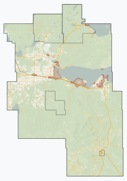
Location in Big Lakes County Location in Alberta | |
| Coordinates: 54°42′38″N 115°24′48″W / 54.71056°N 115.41333°W | |
| Country | Canada |
| Province | Alberta |
| Planning region | Upper Athabasca |
| Municipal district | Big Lakes County |
| Incorporated[1] | |
| • New town | September 1, 1959 |
| • Town | January 1, 1967 |
| Government | |
| • Mayor | Craig Wilson |
| • Governing body | Swan Hills Town Council |
| Area (2021)[3] | |
| • Land | 25.87 km2 (9.99 sq mi) |
| Elevation | 1,113 m (3,652 ft) |
| Population | |
| • Total | 1,201 |
| • Density | 46.4/km2 (120/sq mi) |
| Time zone | UTC−07:00 (MST) |
| • Summer (DST) | UTC−06:00 (MDT) |
| Postal code span | T0G 2C0 |
| Area code(s) | 780, 587, 825 |
| Highways | Highway 32 Highway 33 |
| Waterways | Morse River Freeman River |
| Website | townofswanhills.com |
Swan Hills is a town in northern Alberta, Canada. It is in the eponymous Swan Hills, approximately 80 km (50 mi) north of Whitecourt and 62 km (39 mi) northwest of Fort Assiniboine. The town is at the junction of Highway 32 and Grizzly Trail, and is surrounded by Big Lakes County.
It is the nearest major settlement to the geographic centre of the province. In 1989, local resident Roy Chimiuk used a minimum bounding box method to place a cairn marking the exact location at 54°30′N 115°0′W / 54.500°N 115.000°W, about 30 kilometres south of the town.[6] The site is protected by the Centre of Alberta Natural Area, a 3-kilometre hike from Highway 33.[7]
- ^ "Location and History Profile: Town of Swan Hills" (PDF). Alberta Municipal Affairs. October 7, 2016. p. 625. Retrieved October 13, 2016.
- ^ "Municipal Officials Search". Alberta Municipal Affairs. May 9, 2019. Retrieved October 1, 2021.
- ^ a b Cite error: The named reference
2021censuswas invoked but never defined (see the help page). - ^ "Alberta Private Sewage Systems 2009 Standard of Practice Handbook: Appendix A.3 Alberta Design Data (A.3.A. Alberta Climate Design Data by Town)" (PDF) (PDF). Safety Codes Council. January 2012. pp. 212–215 (PDF pages 226–229). Retrieved October 9, 2013.
- ^ "Population and dwelling counts: Canada and population centres". Statistics Canada. February 9, 2022. Retrieved February 13, 2022.
- ^ "Center of Alberta". Town of Swan Hills. Retrieved September 2, 2019.
- ^ "Centre of Alberta Natural Area". Alberta Parks. June 19, 2017. Retrieved September 2, 2019.


