Back مقاطعة تالبوت (جورجيا) Arabic Talbot County, Georgia BAR Толбът (окръг, Джорджия) Bulgarian টালবট কাউন্টি, জর্জিয়া BPY Talbot Gông (Georgia) CDO Толбот (гуо, Джорджи) CE Talbot County (kondado sa Tinipong Bansa, Georgia) CEB Talbot County, Georgia Welsh Talbot County (Georgia) German Condado de Talbot (Georgia) Spanish
Talbot County | |
|---|---|
 Talbot County Courthouse and Confederate Monument in Talbotton | |
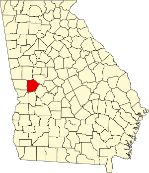
 Location within the U.S. state of Georgia | |
 Georgia's location within the U.S. | |
| Coordinates: 32°43′N 84°32′W / 32.71°N 84.53°W | |
| Country | |
| State | |
| Founded | December 14, 1827 |
| Named for | Matthew Talbot |
| Seat | Talbotton |
| Largest city | Talbotton |
| Area | |
| • Total | 395 sq mi (1,020 km2) |
| • Land | 391 sq mi (1,010 km2) |
| • Water | 3.4 sq mi (9 km2) 0.9% |
| Population (2020) | |
| • Total | 5,733 |
| • Density | 15/sq mi (6/km2) |
| Time zone | UTC−5 (Eastern) |
| • Summer (DST) | UTC−4 (EDT) |
| Congressional district | 2nd |
| Website | talbotcountyga |
Talbot County is a county located in the west central portion of the U.S. state of Georgia. The 2020 census showed a population of 5,733.[1] The county seat and largest city is Talbotton.[2]
- ^ "Census - Geography Profile: Talbot County, Georgia". United States Census Bureau. Retrieved December 29, 2022.
- ^ "Find a County". National Association of Counties. Retrieved June 7, 2011.