| Tanqwa | |
|---|---|
 The Tanqwa River near Abiy Addi | |
Tanqwa River in Tigray Region | |
| Location | |
| Country | Ethiopia |
| Region | Tigray Region |
| Districts (woreda) | Dogu’a Tembien, Kola Tembien, Abergele |
| Physical characteristics | |
| Source | Addi Selam |
| • location | Hagere Selam municipality |
| • elevation | 2,510 m (8,230 ft) |
| Mouth | Giba River |
• location | Barashuwa in Abergele (woreda) |
• coordinates | 13°31′41″N 39°52′41″E / 13.528°N 39.878°E |
• elevation | 1,266 m (4,154 ft) |
| Length | 50 km (31 mi) |
| Basin size | 216 km2 (83 sq mi) |
| Width | |
| • average | 40 m (130 ft) |
| Discharge | |
| • location | Abiy Addi bridge[1] |
| • maximum | 270 m3/s (9,500 cu ft/s) |
| Discharge | |
| • location | Confluence with Giba[1] |
| • maximum | 543 m3/s (19,200 cu ft/s) |
| Basin features | |
| River system | Permanent river |
| Landmarks | Abiy Addi |
| Tributaries | |
| • left | Adawro River, Arwadito, May Qoqah, Tsech'i River |
| Waterbodies | Chini (reservoir) |
| Waterfalls | Rapids |
| Bridges | Abiy Addi |
| Topography | Mountains and deep gorges |
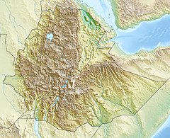
The Tanqwa is a river of northern Ethiopia. Rising in the mountains of Dogu’a Tembien (2510 metres above sea level), it flows westward to Giba River which empties finally in the Tekezé River.[2]

- ^ a b Amanuel Zenebe, and colleagues (2013). "Spatial and temporal variability of river flows in the degraded semi-arid tropical mountains of northern Ethiopia". Zeitschrift für Geomorphologie. 57 (2): 143–169. Bibcode:2013ZGm....57..143Z. doi:10.1127/0372-8854/2012/0080.
- ^ Jacob, M. and colleagues (2019). Geo-trekking map of Dogu'a Tembien (1:50,000). In: Geo-trekking in Ethiopia's Tropical Mountains - The Dogu'a Tembien District. SpringerNature. ISBN 978-3-030-04954-6.

