Te Papapa | |
|---|---|
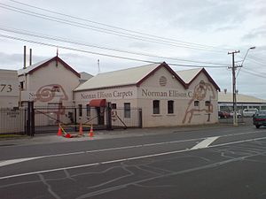
 A carpet factory in the south of the suburb | |
 | |
| Coordinates: 36°55′11″S 174°48′08″E / 36.919602°S 174.802262°E | |
| Country | New Zealand |
| City | Auckland |
| Local authority | Auckland Council |
| Electoral ward | Maungakiekie-Tāmaki ward |
| Local board | Maungakiekie-Tāmaki Local Board |
| Board subdivision | Maungakiekie |
| Area | |
| • Land | 71 ha (175 acres) |
| Population (June 2024)[2] | |
| • Total | 3,510 |
| Train stations | Te Papapa railway station |
| Oranga | Penrose | Mount Wellington |
| Onehunga |
|
Southdown |
| Māngere Bridge | (Māngere Inlet) |
Te Papapa is a suburb of Auckland, New Zealand. It is located nine kilometres to the southeast of Auckland city centre, on the northern shore of Māngere Inlet, an arm of the Manukau Harbour. The residential and light-industrial suburb lies between the suburbs of Onehunga, Penrose, and Southdown, and is at the northern end of the Māngere Bridge which connects it with the South Auckland suburb of Māngere. Train services on the Onehunga Line run through the suburb on the Onehunga Branch line, which reopened in 2010. Services at Te Papapa station commenced on 19 September 2010.[3] Carter Holt Harvey's head office is located at 173 Captain Springs Road in the Te Papapa area.[4] It has been suggested that the name of the suburb refers to a fortress built of rock slabs.[5] However, at the time Te Papapa Railway Station first opened the area around was commonly known as "Pumpkin Flat" and a short article in the Auckland Star[6] reported that the general manager of the railways had chosen to name the station after the "Maori long pumpkin or Te Papapa" in remembrance of the commonly used name.
- ^ Cite error: The named reference
Areawas invoked but never defined (see the help page). - ^ "Aotearoa Data Explorer". Statistics New Zealand. Retrieved 26 October 2024.
- ^ "Onehunga Branch Line". KiwiRail. Retrieved 4 April 2017.
- ^ "ContactArchived 14 October 2008 at the Wayback Machine." Carter Holt Harvey. Retrieved on 28 January 2009.
- ^ Simmons, D. R. (1979). "George Graham's Maori Place Names of Auckland". Records of the Auckland Institute and Museum. 16: 11–39. ISSN 0067-0464. JSTOR 42906272. Wikidata Q58677091.
- ^ "Untitled". Auckland Star. 11 February 1879. p. 2.
