Back Taman Nasional Te Urewera BAN Parc nacional de Te Urewera Catalan Te Urewera National Park German Parque nacional de Te Urewera Spanish Parc national de Te Urewera French הפארק הלאומי טה אורוורה HE テ・ウレウェラ国立公園 Japanese ტე-ურევერის ეროვნული პარკი Georgian Национален парк Те Уревера Macedonian Nationaal park Te Urewera Dutch
| Te Urewera National Park | |
|---|---|
 | |
| Location | Hawke's Bay |
| Nearest city | Gisborne, New Zealand |
| Coordinates | 38°45′0″S 177°9′0″E / 38.75000°S 177.15000°E |
| Area | 2,127 km2 (821 sq mi) |
| Established | 1954 |
| Disestablished | 2014 |
| Governing body | Department of Conservation |
| Website | DOC page |
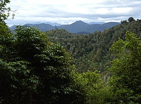
Te Urewera National Park was a national park near the east coast of New Zealand's North Island, established as such in 1954 and disestablished in 2014, when it was replaced by a new legal entity and protected area named Te Urewera.[1] The park covered an area of approximately 2,127 km2 and was located in the north of the Hawke's Bay region of the North Island. It was the largest of four national parks in the North Island and the most isolated rainforest in the region.[2]
- ^ Ruru, Jacinta (October 2014). "Tūhoe-Crown settlement – Te Urewera Act 2014". Māori Law Review: 16–21. Retrieved 13 December 2015.
- ^ "Te Urewera: New Zealand's 'living' rainforest". No. BBC Travel. BBC. 30 September 2021.
