Back مقاطعة تيهاما (كاليفورنيا) Arabic تيهاما كاونتى (كاليفورنيا) ARZ Tehama qraflığı (Kaliforniya) Azerbaijani Tehama County, Kalifornien BAR Тэхейма (акруга) Byelorussian Техама Bulgarian তেহামা কাউন্টি, ক্যালিফোর্নিয়া BPY Техама (гуо, Калифорни) CE Tehama County CEB Tehama County Czech
Tehama County, California | |
|---|---|
| County of Tehama | |
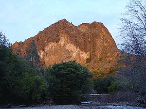
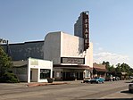
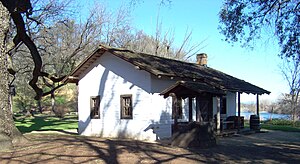
Images, from top down, left to right: Black Rock in the Ishi Wilderness, State Theatre in Red Bluff, Park Headquarters in Lassen Volcanic National Park, front of the William B. Ide Adobe | |
 Interactive map of Tehama County | |
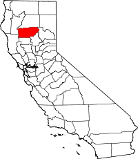
 Location in the state of California | |
| Country | |
| State | |
| Region | Shasta Cascade |
| Incorporated | April 9, 1856 |
| County seat | Red Bluff |
| Largest city | Red Bluff |
| Government | |
| • Type | Council–Administrator |
| • Chair | Bill Moule |
| • Vice Chair | John Leach |
| • Board of Supervisors[1] | Supervisors
|
| • Chief Administrator | Gabriel Hydrick |
| Area | |
• Total | 2,962 sq mi (7,670 km2) |
| • Land | 2,950 sq mi (7,600 km2) |
| • Water | 12 sq mi (30 km2) |
| Highest elevation | 9,239 ft (2,816 m) |
| Population (2020) | |
• Total | 65,829 |
| • Density | 22/sq mi (8.6/km2) |
| GDP | |
| • Total | $2.517 billion (2022) |
| Time zone | UTC-8 (Pacific Standard Time) |
| • Summer (DST) | UTC-7 (Pacific Daylight Time) |
| Congressional district | 1st |
| Website | www.co.tehama.ca.us |
Tehama County (/təˈheɪmə/ tə-HAY-mə; Wintun for "high water") is a county located in the northern part of the U.S. state of California. As of the 2020 census, the population was 65,829.[4] The county seat and largest city is Red Bluff.[5]
Tehama County comprises the Red Bluff, California micropolitan statistical area, which is also included in the Redding-Red Bluff, California combined statistical area. The county is bisected by the Sacramento River.
- ^ "Board of Supervisors".
- ^ Brokeoff Mountain
- ^ "Gross Domestic Product: All Industries in Tehama County, CA". Federal Reserve Economic Data. Federal Reserve Bank of St. Louis.
- ^ "Tehama County, California". United States Census Bureau. Retrieved January 30, 2022.
- ^ "Find a County". National Association of Counties. Retrieved June 7, 2011.


