Back Tenth Avenue Catalan Tenth Avenue (Manhattan) German Décima Avenida (Manhattan) Spanish Tenth Avenue Estonian Hamargarren etorbidea (Manhattan) Basque خیابان دهم Persian Dixième Avenue French השדרה העשירית HE Tenth Avenue (Manhattan) ID 10番街 (マンハッタン) Japanese
KML is from Wikidata
| Amsterdam Avenue (north of 59th Street) | |
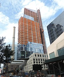
 Tenth Avenue at 17th Street, as seen from the High Line | |
 | |
| Owner | City of New York |
|---|---|
| Maintained by | NYCDOT |
| Length | 10.5 mi (16.9 km)[1] |
| Location | Manhattan, New York City, U.S. |
| South end | |
| North end | Fort George Avenue |
| East | Ninth Avenue (below 59th St) Columbus Avenue (above 59th St) |
| West | Eleventh Avenue (below 59th St) West End Avenue (above 59th St) |
| Construction | |
| Commissioned | March 1811 |


Tenth Avenue, known as Amsterdam Avenue between 59th Street and 193rd Street, is a north-south thoroughfare on the West Side of Manhattan in New York City. It carries uptown (northbound) traffic as far as West 110th Street (also known as Cathedral Parkway), after which it continues as a two-way street.
- ^ "Tenth Avenue / Amsterdam Avenue" (Map). Google Maps. Retrieved December 1, 2015.