Back Thaba Bosigo Afrikaans Thaba Bosiu German Thaba Bosiu Finnish Thaba Bosiu French Thaba Bosiu Italian タバ・ボシウ Japanese Thaba Bosiu Dutch Thaba Bosiu Polish
| Thaba Bosiu | |
|---|---|
| Thaba Bosiu Plateau | |
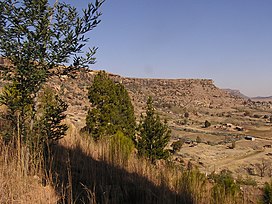
 Thaba Bosiu seen from its northern slopes | |
| Highest point | |
| Coordinates | 29°21′01″S 27°40′17″E / 29.3503°S 27.6713°E |
| Geography | |
| Country | Lesotho |
| Geology | |
| Type of rock | Basalt and Quartzite |
Thaba Bosiu is a constituency and sandstone plateau with an area of approximately 2 km2 (0.77 sq mi) and a height of 1,804 meters above sea level. It is located between the Orange and Caledon Rivers in the Maseru District of Lesotho, 24 km east of the country's capital Maseru.[1] It was once the capital of Lesotho, having been King Moshoeshoe's stronghold.
- ^ Thaba Bosiu; Encyclopædia Britannica 2008. Encyclopædia Britannica Online Library Edition. 7 Apr. 2008 [1].
