Back Geþacasteort ANG Thatcher-Halbinsel German Península Thatcher Spanish Péninsule de Thatcher French Penisola di Thatcher Italian Thatcher Peninsula NN Thatcher Peninsula NB 撒切爾半島 Chinese


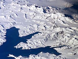
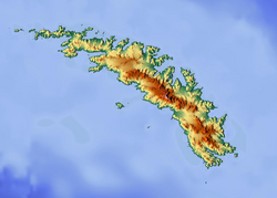
Thatcher Peninsula (54°17′S 36°32′W / 54.283°S 36.533°W) is a mountainous peninsula in north-central South Georgia. Its total area is approximately 5,640 hectares (13,900 acres), with roughly 1,620 ha (4,000 acres) covered in vegetation.[1] It terminates to the north in Mai Point, rising between Cumberland West Bay to the west, and Cumberland East Bay and Moraine Fjord to the east. It is bounded to the southwest and south by Lyell Glacier and Hamberg Glacier. King Edward Cove on the east side of the peninsula is the site of the British Antarctic Survey (BAS) Grytviken station and the disused whaling station of the same name.[2]
Thatcher Peninsula was named by the United Kingdom Antarctic Place-Names Committee (UK-APC) in 1991, at the suggestion of members of the Royal Geographical Society, after Margaret Thatcher, British prime minister, 1979–90. She was described by Sir Vivian Fuchs, chair of the Foreign Office's Antarctic Place Names Committee, as 'a major figure in the history of South Georgia', for her role in the Falklands War.[3][4] Thatcher was, according to friends, "flattered and amused" by the honour.[3]
- ^ Cite error: The named reference
BlackLeewas invoked but never defined (see the help page). - ^ Cite error: The named reference
gnis-TPwas invoked but never defined (see the help page). - ^ a b Cite error: The named reference
times91was invoked but never defined (see the help page). - ^ Cite error: The named reference
times02was invoked but never defined (see the help page).
