Back তিরুপতি বিমানবন্দর Bengali/Bangla Tirupati Airport CEB Flughafen Tirupati German فرودگاه تیروپاتی Persian Aéroport de Tirupati French तिरुपति विमानक्षेत्र Hindi तिरुपती विमानतळ Marathi Lapangan Terbang Tirupati Malay ତିରୁପତି ବିମାନ ବନ୍ଦର OR Aeroportul Tirupati Romanian
Sri Venkateswara Airport | |||||||||||
|---|---|---|---|---|---|---|---|---|---|---|---|
 | |||||||||||
| Summary | |||||||||||
| Airport type | Public | ||||||||||
| Owner/Operator | Airports Authority of India | ||||||||||
| Serves | Tirupati | ||||||||||
| Location | Tirupati, Andhra Pradesh, India | ||||||||||
| Opened | 1971 | ||||||||||
| Focus city for | |||||||||||
| Elevation AMSL | 107 m / 350 ft | ||||||||||
| Coordinates | 13°38′16″N 079°32′50″E / 13.63778°N 79.54722°E | ||||||||||
| Website | Tirupati Airport | ||||||||||
| Map | |||||||||||
 | |||||||||||
| Runways | |||||||||||
| |||||||||||
| Statistics (April 2023 - March 2024) | |||||||||||
| |||||||||||
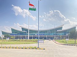
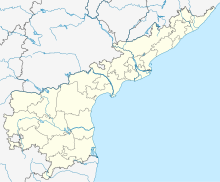
Sri Venkateswara International Airport (IATA: TIR, ICAO: VOTP)[4] is an international airport serving Tirupati, Andhra Pradesh. It is situated in Renigunta, a suburb of Tirupati.[5][6][7] It is 2.8 km (1.7 mi) away from National Highway 71 (previously NH-205),[8] 16 km (9.9 mi) from Tirupati and 39 km (24 mi) from Venkateswara Temple, Tirumala.
- ^ "Annexure III – Passenger Data" (PDF). aai.aero. Retrieved 22 April 2024.
- ^ "Annexure II – Aircraft Movement Data" (PDF). aai.aero. Retrieved 22 April 2024.
- ^ "Annexure IV – Freight Movement Data" (PDF). aai.aero. Retrieved 22 April 2024.
- ^ "Vijayawada, Tirupati airports get global tag". The Hindu. 23 June 2017. Retrieved 8 August 2017.
- ^ "List of International in India by AAI". Airports Authority Of India. 8 September 2021. Retrieved 8 September 2021.
- ^ "Tirupati International Airport" (PDF). Aviation Authority of India.
- ^ Press Trust of India. "No foreign flights at Tirupati, Vijaywada airports after international tag | Business Standard News". Business-standard.com. Retrieved 24 November 2018.
- ^ AAI. "Pre Feasibility report" (PDF). EnvironmentalClearance.nic.in. Retrieved 26 October 2019.

