Toodyay Road | |
|---|---|
 | |
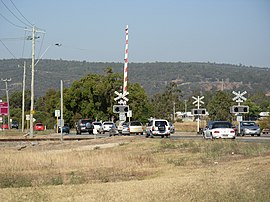
| Toodyay Road railway crossing, Middle Swan | |
 | |
| General information | |
| Type | Road |
| Length | 64 km (40 mi) |
| Opened | 1838 |
| Route number(s) | |
| Major junctions | |
| Southwest end | |
| |
| Northeast end | Goomalling-Toodyay Road, Toodyay |
| Location(s) | |
| Major suburbs | Red Hill, Gidgegannup |
| ---- | |
Toodyay Road is a mostly 2-lane undivided single carriageway in Western Australia, running from the north-eastern Perth suburb of Middle Swan, through Gidgegannup and Bailup, to the Wheatbelt town of Toodyay. It is signposted as State Route 50.
It rises up the Darling Scarp at Red Hill and travels through the easternmost section of the City of Swan.
