Back Toorak (bahin nga lungsod) CEB Toorak German توراک، ویکتوریا Persian Toorak French Toorak Malagasy Toorak Dutch Toorak (Victoria) NB Toorak Swedish تورک، وکٹوریہ Urdu
| Toorak Melbourne, Victoria | |||||||||||||||
|---|---|---|---|---|---|---|---|---|---|---|---|---|---|---|---|
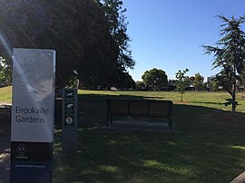
 Brookville Gardens, Toorak | |||||||||||||||
 | |||||||||||||||
| Coordinates | 37°50′28″S 145°01′05″E / 37.841°S 145.018°E | ||||||||||||||
| Population | 12,817 (2021 census)[1] | ||||||||||||||
| • Density | 2,980/km2 (7,720/sq mi) | ||||||||||||||
| Established | 1850s | ||||||||||||||
| Postcode(s) | 3142 | ||||||||||||||
| Elevation | 32 m (105 ft) | ||||||||||||||
| Area | 4.3 km2 (1.7 sq mi) | ||||||||||||||
| Location | 5 km (3 mi) from Melbourne | ||||||||||||||
| LGA(s) | City of Stonnington | ||||||||||||||
| State electorate(s) | |||||||||||||||
| Federal division(s) | Higgins | ||||||||||||||
| |||||||||||||||
Toorak (/ˈtuːræk/)[2] is a suburb of Melbourne, Victoria, Australia, 5 km (3.1 mi) south-east of Melbourne's Central Business District, located within the City of Stonnington local government area.[3] Toorak recorded a population of 12,817 at the 2021 census.[1]
The name Toorak has become synonymous with wealth and privilege, the suburb long having the reputation of being Melbourne's most elite, and ranking among the most prestigious in Australia. It has the highest average property values in Melbourne, and is one of the most expensive suburbs in Australia. It is the nation's second highest earning postcode after Point Piper in Sydney.[4]
Located on a rise on the south side (or left bank) of a bend in the Yarra River, Toorak is bordered by South Yarra, at Williams Road on the west, Malvern, at Glenferrie Road on the east, Prahran and Armadale, at Malvern Road to the south and the suburbs of Richmond, Burnley and Hawthorn on the north side of the river. The suburb's main street is considered to be Toorak Road, on which the commercial area of Toorak Village is located.
- ^ a b Australian Bureau of Statistics (28 June 2022). "Toorak (Suburbs and Localities)". 2021 Census QuickStats. Retrieved 17 July 2022.
- ^ "ABC Pronounce". Australian Broadcasting Corporation. 19 July 1989. Retrieved 11 May 2020.
- ^ "Indigenous history".
- ^ The top 10 richest postcodes in Australia 9 Finance 27 April 2018
