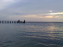
 Topsail Island sound side | |
| Geography | |
|---|---|
| Location | Atlantic Ocean |
| Coordinates | 34°28′11″N 77°28′19″W / 34.46972°N 77.47194°W |
| Length | 26 mi (42 km) |
| Administration | |
US | |
| Additional information | |
 | |
Topsail Island (/ˈtɑːpsɪl/, TOP-sill) is a 26-mile (41.8 km) long barrier island off the coast of North Carolina, roughly equidistant between the barrier islands of the Crystal Coast and the beaches of the Cape Fear region, lying south of Jacksonville, North Carolina and Camp Lejeune. The northeastern edge of the island is the New River Inlet, and the southwestern edge is New Topsail Inlet. It is separated from the mainland by a series of small sounds and channels that make up a portion of the Atlantic Intracoastal Waterway.

It includes the communities of North Topsail Beach, Surf City, and Topsail Beach. Along with its thick maritime forests, Topsail Island is also a sanctuary for sea turtles and is known for its beautiful beaches. The island lies in Onslow County in the north and in Pender County in the south. There are only two ways on and off the island: a high-rise bridge in Surf City and a high-rise bridge in North Topsail Beach. It is also known for its varieties of Coral and fossils and supports team-seas.


