Back توسون (ماريلند) Arabic تووسون، مریلند AZB Towson BAR Towson Catalan Towson CEB Towson (Maryland) Danish Townson DAG Towson German Towson (Maryland) Spanish Towson (Maryland) Basque
Towson, Maryland | |
|---|---|
| Motto: | |
 Location within Baltimore County | |
| Coordinates: 39°23′35″N 76°36′34″W / 39.39306°N 76.60944°W | |
| Country | |
| State | |
| County | |
| Area | |
• Total | 14.29 sq mi (37.01 km2) |
| • Land | 14.15 sq mi (36.66 km2) |
| • Water | 0.14 sq mi (0.35 km2) |
| Elevation | 463 ft (141 m) |
| Population (2020) | |
• Total | 59,553 |
| • Density | 4,207.80/sq mi (1,624.62/km2) |
| Time zone | UTC−5 (Eastern (EST)) |
| • Summer (DST) | UTC−4 (EDT) |
| ZIP codes | 21286, 21204, 21252, 21212, 21209, 21210, 21239 (county)[2] |
| Area code(s) | 410, 443, and 667 |
| FIPS code | 24-78425 |
| GNIS feature ID | 0591420 |
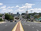
Towson (/ˈtaʊsən/)[3] is an unincorporated community and a census-designated place in Baltimore County, Maryland, United States. The population was 59,533 in the 2020 census. It is the county seat[4] of Baltimore County and the second-most populous unincorporated county seat in the United States (after Ellicott City, the seat of nearby Howard County, southwest of Baltimore).[5]
- ^ "2020 U.S. Gazetteer Files". United States Census Bureau. Retrieved April 26, 2022.
- ^ "Towson Maryland ZIP Codes - Map and Full List". Zipdatamaps.
- ^ "Definition of Towson". merriam-webster.com. Retrieved September 9, 2018.
- ^ "NACo County Explorer". National Association of Counties.
- ^ "Towson, Maryland: A Great Place to Live, Work & Play!—A Synopsis of Towson, MD". Towson Chamber of Commerce. 2006. Archived from the original on February 12, 2008. Retrieved January 11, 2008.


