Back أونا (سافا) Arabic نهر انا ARZ Una çayı (Sava) Azerbaijani Уна Bulgarian Una BS Riu Una Catalan Una (suba sa Bosniya ug Ersogobina) CEB Una Czech Una (Fluss) German Ούνα (ποταμός) Greek
| Una | |
|---|---|
 The Štrbački buk waterfall on the Una river | |
 | |
| Etymology | Latin una - one, unique |
| Location | |
| Countries | |
| Physical characteristics | |
| Source | Vrelo Une |
| • location | Donja Suvaja |
| • coordinates | 44°23′58″N 16°06′14″E / 44.399457°N 16.103796°E |
| • elevation | 358,850 m (1,177,330 ft) |
| Mouth | Sava |
• location | Jasenovac |
• coordinates | 45°16′12″N 16°55′05″E / 45.270°N 16.918°E |
• elevation | 95 m (312 ft) |
| Length | 214.6 km (133.3 mi) |
| Basin size | 10,200 km2 (3,900 sq mi) |
| Discharge | |
| • location | Mouth |
| • average | 240.3 m3/s (8,490 cu ft/s) |
| • minimum | 40.95 m3/s (1,446 cu ft/s) |
| • maximum | 1,500 m3/s (53,000 cu ft/s) |
| Basin features | |
| Progression | Sava—Danube—Black Sea |
| River system | Sava basin |
| Population | 620.373 |
| Tributaries | |
| • left |
|
| • right | |
| Waterfalls |
|
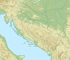
The Una (Serbian Cyrillic: Уна, pronounced [ûna]) is a border river between Bosnia and Herzegovina and Croatia and a right tributary of the Sava river.[1] It is part of the Black Sea drainage basin, and its watershed has a size of 10,200 km2 (3,900 sq mi), of which 8,080 km2 (3,120 sq mi) belongs to Bosnia and Herzegovina, and 2,120 km2 (820 sq mi) to Croatia. The total length of the river is 212 km (132 mi).[2] The source of the river is located near the village of Donja Suvaja in Croatia, and its mouth is located near the village of Jasenovac, on the border with Bosnia. The largest right tributaries are the Krka, Unac, Krušnica and Sana rivers, and the largest left tributary is the Klokot river. Its longest headwater is the Unac river. The largest and most important city located on the river is Bihać. Other, important cities and towns are Bosanska Krupa, Bosanski Novi and Bosanska Kostajnica. The river is characterized by a multitude of waterfalls, rapids, karst springs and relatively untouched nature. A large part of the upper river is part of the Una National Park.
- ^ Library, Civil Society. "Akcijski plan zaštite gornjeg toka rijeke Une". CSL (Civil Society Library). Retrieved 2020-07-24.
- ^ "Plan upravljanja vodama za vodno područje rijeke Save u Federaciji Bosne i Hercegovine (Water management plan for the water area of the Sava River in the Federation of Bosnia and Herzegovina)" (PDF) (in Bosnian).
