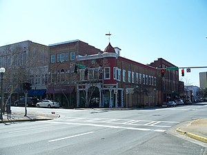
Valdosta metropolitan area | |
|---|---|
| Valdosta, GA metropolitan statistical area | |
 Valdosta Commercial Historic District | |
 | |
| Country | |
| State | |
| Largest city | Valdosta |
| Area | |
| • Total | 1,607.4 sq mi (4,163 km2) |
| Population (2023) | |
| • Total | 151,118 |
| • Density | 94.2/sq mi (36.4/km2) |
| Time zone | UTC−5 (EST) |
| • Summer (DST) | UTC−4 (EDT) |
| Area code | 229 |
The Valdosta metropolitan area, designated the Valdosta metropolitan statistical area by the U.S. Office of Management and Budget, is a metropolitan statistical area consisting of four counties—Brooks, Echols, Lanier, and Lowndes—centered on the city of Valdosta. Located in Southeast Georgia, the metropolitan area's population was 151,118 according to 2023 U.S. census estimates, up from 149,849 at the 2020 U.S. census.[1]
- ^ "Metropolitan and Micropolitan Statistical Areas Population Totals: 2020-2022". U.S. Census Bureau. Retrieved 2024-01-30.
