Back مقاطعة فيرميليون (إلينوي) Arabic Vermilion County, Illinois BAR Верміліян (акруга, Ілінойс) Byelorussian Върмилиън (окръг, Илинойс) Bulgarian ভারমেলিয়ন কাউন্টি, ইলিনয়স BPY Vermilion Gông (Illinois) CDO Вермилион (гуо, Иллинойс) CE Vermilion County CEB Vermilion County, Illinois Welsh Vermilion County German
Vermilion County, Illinois | |
|---|---|
Vermilion County Courthouse | |
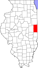
 Location within Illinois | |
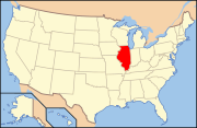
 Illinois' location within the United States | |
| Coordinates: 40°07′28.13″N 87°37′48.07″W / 40.1244806°N 87.6300194°W | |
| Country | United States |
| State | Illinois |
| Region | Central Illinois |
| Metro area | Danville Micropolitan |
| Incorporated | January 18, 1826 |
| Named for | Vermilion River |
| County seat and largest city | Danville |
| Area | |
| • Total | 901.28 sq mi (2,334.3 km2) |
| • Land | 898.37 sq mi (2,326.8 km2) |
| • Water | 2.91 sq mi (7.5 km2) |
| • Rank | 7th largest county in Illinois |
| Population (2020) | |
| • Total | 74,188 |
| • Density | 82/sq mi (32/km2) |
| Time zone | UTC−6 (Central) |
| • Summer (DST) | UTC−5 (Central) |
| ZIP Code prefixes | 60932, 60942, 60960, 60963, 61810, 61811, 61812, 61814, 61817, 61831, 61832, 61833, 61834, 61841, 61844, 61846, 61848, 61849, 61850, 61857, 61858, 61859, 61862, 61865, 61870, 61876, 61883 |
| Area codes | 217/447 |
| Congressional district | 2nd, 15th |
| Website | www.vercounty.org |
Vermilion County is a county in the eastern part of the U.S. state of Illinois, between the Indiana border and Champaign County. It was established in 1826 and was the 45th of Illinois' 102 counties. According to the 2020 United States census, it had a population of 74,188.[1] It contains 21 incorporated settlements; the county seat and largest city is Danville.[2]
Vermilion County is part of the Danville, IL Micropolitan Statistical Area, as well as the larger Champaign–Urbana–Danville Combined Statistical Area.
- ^ "Vermilion County, Illinois". United States Census Bureau. Retrieved June 10, 2023.
- ^ "Find a County – Vermilion County IL". National Association of Counties. Archived from the original on April 16, 2013. Retrieved January 6, 2011.

