Vevring Municipality
Vevring herad | |
|---|---|
 View of the local Vevring Church | |
 Sogn og Fjordane within Norway | |
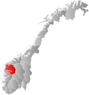
 Vevring within Sogn og Fjordane | |
| Coordinates: 61°29′32″N 5°24′24″E / 61.4922°N 5.4067°E | |
| Country | Norway |
| County | Sogn og Fjordane |
| District | Sunnfjord |
| Established | 1 Jan 1838 |
| • Created as | Formannskapsdistrikt |
| Disestablished | 1 Jan 1964 |
| • Succeeded by | Flora, Askvoll, and Naustdal municipalities |
| Administrative centre | Indrevevring |
| Area (upon dissolution) | |
| • Total | 120 km2 (50 sq mi) |
| Population (1964) | |
| • Total | 464 |
| • Density | 3.9/km2 (10/sq mi) |
| Time zone | UTC+01:00 (CET) |
| • Summer (DST) | UTC+02:00 (CEST) |
| ISO 3166 code | NO-1434[1] |
Vevring is a former municipality in the old Sogn og Fjordane county, Norway. The municipality existed from 1838 until its dissolution in 1964. It encompassed the land surrounding the western part of the Førdefjorden on both the north and south shores of the fjord in what is now Kinn, Askvoll, and Sunnfjord municipalities in Vestland county. It stretched from the Ålasundet strait (the narrowest part of the fjord) in the east to the mouth of the fjord in the west and from the Steindalen valley in the north to the mountains south of the fjord. The municipality was 120 square kilometres (46 sq mi) in 1964 when it was dissolved.
The administrative centre of the municipality was the village of Indrevevring (on the north shore of the fjord), where the Vevring Church is located. The village of Kvammen, across the fjord from Indrevevring was the main village on the south side of the fjord.
- ^ Bolstad, Erik; Thorsnæs, Geir, eds. (26 January 2023). "Kommunenummer". Store norske leksikon (in Norwegian). Kunnskapsforlaget.
