| Wallacia Sydney, New South Wales | |||||||||||||||
|---|---|---|---|---|---|---|---|---|---|---|---|---|---|---|---|
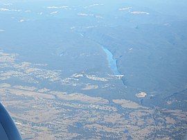
 Aerial view of Warragamba Dam, Silverdale, and Wallacia | |||||||||||||||
 | |||||||||||||||
| Population | 1,711 (2021 census)[1] | ||||||||||||||
| Established | 1906 | ||||||||||||||
| Postcode(s) | 2745 | ||||||||||||||
| Elevation | 58 m (190 ft) | ||||||||||||||
| Location | 68 km (42 mi) west of Sydney CBD | ||||||||||||||
| LGA(s) | |||||||||||||||
| State electorate(s) | |||||||||||||||
| Federal division(s) | Hume | ||||||||||||||
| |||||||||||||||
Wallacia is a suburb of Sydney, in the state of New South Wales, Australia. Formerly a rural village it is 68 kilometres (42 mi) west of the Sydney GPO (General Post Office), in the local government areas of the City of Penrith, City of Liverpool and Wollondilly Shire. It is part of the Greater Western Sydney region.
- ^ Australian Bureau of Statistics (28 June 2022). "Wallacia (State Suburb)". 2021 Census QuickStats. Retrieved 19 October 2024.
