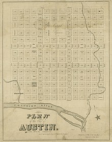
The 1839 Austin city plan (commonly known as the Waller Plan) is the original city plan for the development of Austin, Texas, which established the grid plan for what is now downtown Austin. It was commissioned in 1839 by the government of the Republic of Texas and developed by Edwin Waller, a Texian revolutionary and politician who would later become Austin's first mayor.
