| Warm Fork Spring River Tributary to Spring River | |
|---|---|
| Location | |
| Country | United States |
| State | Missouri Arkansas |
| County | Fulton (AR) Oregon (MO) |
| City | Thayer, MO |
| Physical characteristics | |
| Source | confluence of Howell Creek and Elk Creek |
| • location | about 3 miles northeast of Brandsville, Missouri |
| • coordinates | 36°40′35.87″N 091°38′59.64″W / 36.6766306°N 91.6499000°W[2] |
| • elevation | 750 ft (230 m)[1] |
| Mouth | Spring River |
• location | Mammoth Spring, Arkansas |
• coordinates | 36°29′40.23″N 091°23′9.51″W / 36.4945083°N 91.3859750°W[1] |
• elevation | 492 ft (150 m)[1] |
| Length | 19.21 mi (30.92 km)[3] |
| Basin size | 238.04 square miles (616.5 km2)[4] |
| Discharge | |
| • location | Spring River |
| • average | 317.46 cu ft/s (8.989 m3/s) at mouth with Spring River[4] |
| Basin features | |
| Progression | Spring River → Black River → White River → Mississippi River → Gulf of Mexico |
| River system | White River |
| Tributaries | |
| • left | Elk Creek Anthony Branch Cox Creek |
| • right | Howell Creek Bay Creek |
| Bridges | County Road M, unnamed road (x4), Oregon County 327, unnamed road, MO 19, E Adams Street, Warm Fork Road, US 63, W Walnut Street, US 63, unnamed road |
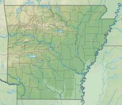
The Warm Fork Spring River is a stream in Oregon County, Missouri, and northern Fulton County, Arkansas, United States.[1] The stream begins in western Oregon County at the confluence of Howell Creek and Elk Creek and the stream becomes the Spring River at its confluence with the cold springwaters of Mammoth Spring in northern Fulton County.
The stream was named due to the temperature difference between its waters and the cold springwaters entering from Mammoth Spring.[5] This is the only stream of this name in the United States.[2]
- ^ a b c d U.S. Geological Survey Geographic Names Information System: Warm Fork Spring River
- ^ a b "Geographic Names Information System". edits.nationalmap.gov. US Geological Survey. Retrieved 14 January 2023.
- ^ "ArcGIS Web Application". epa.maps.arcgis.com. US EPA. Retrieved January 14, 2023.
- ^ a b "Watershed Report | Office of Water | US EPA". watersgeo.epa.gov. US EPA. Retrieved 14 January 2023.
- ^ Oregon County Place Names, 1928–1945, The State Historical Society of Missouri


