| Warriors' Path State Park, Tennessee | |
|---|---|
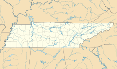
Map of Tennessee showing the location of Warriors' Path State Park | |
| Location | Kingsport, Sullivan County, Tennessee, United States |
| Nearest city | Kingsport, Tennessee |
| Coordinates | 36°29′29″N 82°29′02″W / 36.49139°N 82.48389°W |
| Area | 950 acres (3.8 km2) |
| Established | 1952 |
| Governing body | Tennessee Department of Environment and Conservation |
| Website | Warriors' Path State Park |


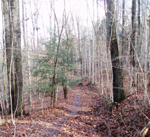
Warriors' Path State Park is a 950-acre (3.84 km2) Tennessee State Park in Colonial Heights, Tennessee, an area within the city of Kingsport. It is named for the Great Indian Warpath that was used by the Iroquois in war raids with the Cherokee and other tribes. The park is located around the Fort Patrick Henry Reservoir and Duck Island on the South Fork Holston River. This land was acquired from the Tennessee Valley Authority in 1952.[1]
- ^ "Official Warriors' Path State Park website". Retrieved May 15, 2008.

