Back مقاطعة واساتش (يوتا) Arabic Wasatch County, Utah BAR Уосач (акруга) Byelorussian Уосач (окръг) Bulgarian ৱাসাটচ কাউন্টি, ইউটা BPY Wasatch Gông (Utah) CDO Уосатч (гуо, Юта) CE Wasatch County CEB Wasatch County Czech Wasatch County, Utah Welsh
Wasatch County | |
|---|---|
 | |
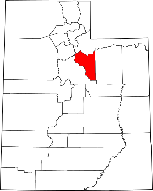
 Location within the U.S. state of Utah | |
 Utah's location within the U.S. | |
| Coordinates: 40°20′N 111°10′W / 40.33°N 111.16°W | |
| Country | |
| State | |
| Founded | 1862 |
| Named for | Ute word for mountain pass |
| Seat | Heber City |
| Largest city | Heber City |
| Area | |
| • Total | 1,206 sq mi (3,120 km2) |
| • Land | 1,176 sq mi (3,050 km2) |
| • Water | 30 sq mi (80 km2) 2.5% |
| Population (2020) | |
| • Total | 34,788 |
| • Density | 29/sq mi (11/km2) |
| Time zone | UTC−7 (Mountain) |
| • Summer (DST) | UTC−6 (MDT) |
| Congressional district | 3rd |
| Website | www |
Wasatch County (/ˈwɑːsætʃ/ WAH-satch) is a county in the U.S. state of Utah. As of the 2020 United States Census, the population was 34,788.[1] Its county seat and largest city is Heber City.[2] The county was named for a Ute word meaning "mountain pass" or "low place in the high mountains".
Wasatch County is part of the Heber, UT Micropolitan Statistical Area as well as the Salt Lake City-Provo-Orem, UT Combined Statistical Area.
- ^ "Wasatch County, Utah". United States Census Bureau. Retrieved July 1, 2023.
- ^ "Find a County". National Association of Counties. Retrieved June 7, 2011.
