Back ويلند (ميشيغان) Arabic وايلاند (اليجان) ARZ وایلند، میشیقان AZB Вейленд (Мичиган) CE Wayland (lungsod sa Estados Unidos, Michigan) CEB Wayland, Michigan Welsh Wayland (Míchigan) Spanish Wayland (Michigan) Basque وایلند، میشیگان Persian Wayland (Michigan) French
Wayland, Michigan | |
|---|---|
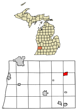
 Location of Wayland, Michigan | |
| Coordinates: 42°40′28″N 85°38′44″W / 42.67444°N 85.64556°W | |
| Country | United States |
| State | Michigan |
| County | Allegan |
| Area | |
| • Total | 3.01 sq mi (7.79 km2) |
| • Land | 2.96 sq mi (7.67 km2) |
| • Water | 0.04 sq mi (0.12 km2) |
| Elevation | 420 ft (69 m) |
| Population (2020) | |
| • Total | 4,435 |
| • Density | 1,497.30/sq mi (578.05/km2) |
| Time zone | UTC-5 (Eastern (EST)) |
| • Summer (DST) | UTC-4 (EDT) |
| ZIP code | 49348 |
| Area code | 269 |
| FIPS code | 26-84880[2] |
| GNIS feature ID | 1615899[3] |
| Website | www |
Wayland is a city in Allegan County in the U.S. state of Michigan. The population was 4,435 at the 2020 census.[4]
The city is located at the northwest corner of Wayland Township, but is politically independent. The city has also incorporated a portion of land in the south of adjacent Leighton Township. U.S. Route 131 forms the western boundary of the city.
- ^ "2020 U.S. Gazetteer Files". United States Census Bureau. Retrieved May 21, 2022.
- ^ "U.S. Census website". United States Census Bureau. Retrieved 2008-01-31.
- ^ U.S. Geological Survey Geographic Names Information System: Wayland, Michigan
- ^ "Wayland city, Michigan - Census Bureau Profile". United States Census Bureau. Retrieved 11 February 2024.