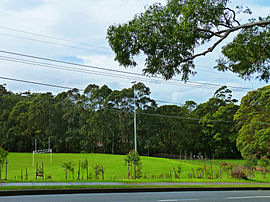
| West Pymble Sydney, New South Wales | |||||||||||||||
|---|---|---|---|---|---|---|---|---|---|---|---|---|---|---|---|
 Bicentennial Park, Yanko Road | |||||||||||||||
 | |||||||||||||||
| Population | 5,441 (SAL 2021)[1] | ||||||||||||||
| • Density | 1,489[2]/km2 (3,860/sq mi) | ||||||||||||||
| Postcode(s) | 2073 | ||||||||||||||
| Elevation | 85 m (279 ft) | ||||||||||||||
| Area | 3.70[2] | ||||||||||||||
| Location | 18 km (11 mi) north-west of Sydney CBD | ||||||||||||||
| LGA(s) | Ku-ring-gai Council | ||||||||||||||
| State electorate(s) | Ku-ring-gai | ||||||||||||||
| Federal division(s) | Bradfield | ||||||||||||||
| |||||||||||||||
West Pymble is a suburb on the Upper North Shore of Sydney in the state of New South Wales, Australia 15 kilometres (9.3 mi) north-west of the Sydney Central Business District in the local government area of Ku-ring-gai Council. Pymble is a separate suburb to the east, sharing the postcode of 2073.
- ^ Australian Bureau of Statistics (28 June 2022). "West Pymble (suburb and locality)". Australian Census 2021 QuickStats. Retrieved 28 June 2022.
- ^ a b "West Pymble About the profile areas". Informed Decisions. Archived from the original on 14 August 2024. Retrieved 14 August 2024.
