Whangaroa | |
|---|---|
 Whangaroa | |
 | |
| Coordinates: 35°3′8″S 173°44′31″E / 35.05222°S 173.74194°E | |
| Country | New Zealand |
| Region | Northland Region |
| District | Far North District |
| Ward | Bay of Islands/Whangaroa |
| Community | Bay of Islands-Whangaroa |
| Subdivision | Whangaroa |
| Electorates | |
| Government | |
| • Territorial Authority | Far North District Council |
| • Regional council | Northland Regional Council |
| • Mayor of Far North | Moko Tepania |
| • Northland MP | Grant McCallum |
| • Te Tai Tokerau MP | Mariameno Kapa-Kingi |
| Area | |
| • Total | 1.24 km2 (0.48 sq mi) |
| Population (June 2024)[2] | |
| • Total | 150 |
| • Density | 120/km2 (310/sq mi) |

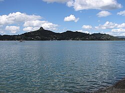
Whangaroa, also known as Whangaroa Village to distinguish it from the larger area of the former Whangaroa County, is a settlement on Whangaroa Harbour in the Far North District of New Zealand. It is 8 km north-west of Kaeo and 35 km north-west of Kerikeri. The harbour is almost landlocked and is popular both as a fishing spot in its own right and as a base for deep-sea fishing.[3]
- ^ Cite error: The named reference
Areawas invoked but never defined (see the help page). - ^ "Aotearoa Data Explorer". Statistics New Zealand. Retrieved 26 October 2024.
- ^ "Whangaroa Travel Guide". Jasons Travel Media.
