Back جبل وايلير پياك ARZ Wheeler Peak (bukid sa Tinipong Bansa, New Mexico) CEB Wheeler Peak (Nové Mexiko) Czech Wheeler Peak (New Mexico) German Pico Wheeler Spanish ویلر پیگ (نیومکزیکو) Persian Pic Wheeler (Nouveau-Mexique) French Wheeler Peak (Nuovo Messico) Italian Wheeler Peak (New Mexico) LLD Wheeler Peak (New Mexico) Dutch
| Wheeler Peak | |
|---|---|
 Wheeler Peak | |
| Highest point | |
| Elevation | 13,167 ft (4,013 m) NAVD 88[1] |
| Prominence | 3,409 ft (1,039 m)[2] |
| Parent peak | Vermejo Peak |
| Listing | |
| Coordinates | 36°33′25″N 105°25′01″W / 36.556855136°N 105.416947028°W[1] |
| Geography | |
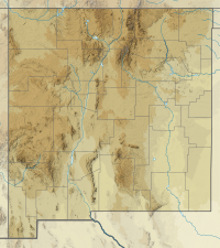
| Location | Taos County, New Mexico, U.S. |
| Parent range | Taos Mountains |
| Topo map | USGS Wheeler Peak |
| Climbing | |
| Easiest route | Williams Lake |

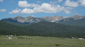
Wheeler Peak is the highest natural point in the U.S. state of New Mexico. It is located northeast of Taos and south of Red River in the northern part of the state, and just 2 miles (3.2 km) southeast of the ski slopes of Taos Ski Valley. It lies in the Sangre de Cristo Mountains, the southernmost subrange of the Rocky Mountains. The peak's elevation is 13,167 feet (4,013 m).
Formerly named Taos Peak, after the nearby town of Taos, New Mexico, it was renamed Wheeler Peak in 1950.[3] A plaque at the summit states that the mountain was:
Named in honor of Major George Montague Wheeler (1832–1909) who for ten years led a party of surveyors and naturalists collecting geologic, biologic, planimetric and topographic data in New Mexico and six other southwestern states.
- ^ a b "Wheeler". NGS Data Sheet. National Geodetic Survey, National Oceanic and Atmospheric Administration, United States Department of Commerce. Retrieved 2017-03-24.
- ^ "Wheeler Peak, New Mexico". Peakbagger.com. Retrieved 2008-12-21.
- ^ "Wheeler Peak". Geographic Names Information System. United States Geological Survey, United States Department of the Interior. Retrieved 2008-12-22.
