| Wild River State Park | |
|---|---|
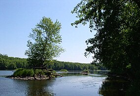
 Wild River State Park protects shoreline along the St. Croix, a National Wild and Scenic River | |
| Location | Chisago, Minnesota, United States |
| Coordinates | 45°34′5″N 92°52′33″W / 45.56806°N 92.87583°W |
| Area | 6,574 acres (26.60 km2) |
| Elevation | 774 ft (236 m)[1] |
| Established | 1973 |
| Governing body | Minnesota Department of Natural Resources |
Point Douglas to Superior Military Road: Deer Creek Section | |
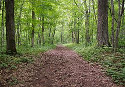
 Park trail following the route of the Point Douglas to Superior Military Road | |
| Location | Amador Township |
| Coordinates | 45°30′22″N 92°43′4″W / 45.50611°N 92.71778°W |
| Area | 2.2 acres (0.9 ha) |
| Built | 1853 |
| Built by | John Rollins |
| Engineer | James Hervey Simpson |
| Architectural style | earth road |
| MPS | Minnesota Military Roads, 1850–1857 |
| NRHP reference No. | 90002200 |
| Added to NRHP | 1991-02-07 |
Wild River State Park is a state park of Minnesota, United States, curving along 18 miles (29 km) of the St. Croix River. This long, narrow park is shaped somewhat like a sideways 'S', with development largely concentrated in the lower third. The remote upper sections flank the mouth of a tributary called the Sunrise River. The park is managed to provide quieter, more nature-oriented recreation as a counterpoint to the busier William O'Brien and Interstate State Parks downstream.[2]
Wild River State Park is named after the St. Croix's designation as a National Wild and Scenic River. The park contains the Point Douglas to Superior Military Road: Deer Creek Section, a surviving section of the Point Douglas to Superior Military Road built in 1853, which is listed on the National Register of Historic Places.
- ^ "Saint Croix Wild River State Park". Geographic Names Information System. United States Geological Survey. March 25, 1999. Retrieved February 25, 2011.
- ^ "Wild River State Park Management Plan" (PDF). Minnesota Department of Natural Resources, Division of Parks and Recreation. February 2007. Retrieved May 27, 2013.
{{cite journal}}: Cite journal requires|journal=(help)


