This article needs additional citations for verification. (December 2009) |
| McPhillips Street | ||||
Route 180 highlighted in red | ||||
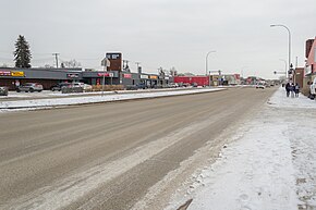
 McPhillips Street as seen from its intersection with Machray Avenue. | ||||
| Route information | ||||
| Maintained by City of Winnipeg | ||||
| Length | 9.6 km[1] (6.0 mi) | |||
| Existed | 1966–present | |||
| Major junctions | ||||
| South end | ||||
| North end | ||||
| Location | ||||
| Country | Canada | |||
| Province | Manitoba | |||
| Highway system | ||||
| ||||
Route 180 (locally known as McPhillips Street) is a major arterial road and city route in northwestern Winnipeg, Manitoba, Canada. It runs from Route 57 (Notre Dame Avenue) to Emes Avenue (Winnipeg city limits) near the Perimeter Highway, where it becomes Highway 8.
The route is the highest-numbered city route in Winnipeg. It serves as a connector to Highway 8 and Selkirk, Manitoba, from downtown Winnipeg via Notre Dame Ave. The speed limit is 60 km/h (37 mph) in the suburban area, except approaching the Perimeter where the speed limit becomes 80 km/h (50 mph).
Among other things, the route is home to the McPhillips Station Casino.


