Back Yass Valley CEB Yass Valley Council German Conseil de la vallée du Yass French Municipalità di Yass Valley Italian Yass Valley Council Dutch Yass Valley Swedish
| Yass Valley New South Wales | |||||||||||||||
|---|---|---|---|---|---|---|---|---|---|---|---|---|---|---|---|
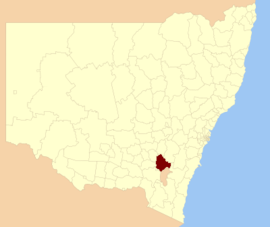
 Location in New South Wales | |||||||||||||||
| Coordinates | 34°51′S 148°55′E / 34.850°S 148.917°E | ||||||||||||||
| Population |
| ||||||||||||||
| • Density | 4.0365/km2 (10.4545/sq mi) | ||||||||||||||
| Established | 11 February 2004 | ||||||||||||||
| Area | 3,999 km2 (1,544.0 sq mi) | ||||||||||||||
| Mayor | Jasmin Jones | ||||||||||||||
| Council seat | Yass[3] | ||||||||||||||
| Region | Southern Tablelands | ||||||||||||||
| State electorate(s) | Goulburn | ||||||||||||||
| Federal division(s) | Eden-Monaro | ||||||||||||||
| Website | Yass Valley | ||||||||||||||
| |||||||||||||||
Yass Valley Council is a local government area in the Southern Tablelands region of New South Wales, Australia. The area is located adjacent to the Hume and Barton Highways and the Main Southern railway line.
The Shire includes the towns, and extensive rural and residential areas of:
It also includes the localities of:
The Yass Shire was proclaimed on 1 January 1980 following the amalgamation of Goodradigbee Shire and the Municipality of Yass. Yass Shire in turn was dissolved and merged into the Yass Valley Council on 11 February 2004, following a further amalgamation of Yass Shire and parts of Gunning and Yarrowlumla Shires.
The mayor of Yass Valley Council is Cr. Allan McGrath.
- ^ Australian Bureau of Statistics (27 June 2017). "Yass Valley (A)". 2016 Census QuickStats. Retrieved 5 July 2017.
- ^ "3218.0 – Regional Population Growth, Australia, 2017–18". Australian Bureau of Statistics. 27 March 2019. Retrieved 27 March 2019. Estimated resident population (ERP) at 30 June 2018.
- ^ "Yass Valley Council". Department of Local Government. Retrieved 12 November 2006.