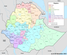
Yem Zone is one of the zones in the Central Ethiopia Regional State. Yem is named for the Yem, people whose homeland lies in this zone, (see Kingdom of Yamma). Yem is bordered on the west and north by the Oromia Region, and separated from Gurage on the northeast and Hadiya on the east by the Omo River. High points in Yem include Mount Bor Ama, Mount Azulu and Mount Toba. The administrative center of Yem is Saja.
The form of subsistence agriculture practiced in this zone is based on cereal and enset. Important cash crops include teff, wheat, barley and pulses. Other important non-agricultural sources of income include selling butter and remittances.[1] According to a 2004 report, Yem had 12 kilometers of asphalt roads, 11 kilometers of all-weather roads and 31 kilometers of dry-weather roads, for an average road density of 81 kilometers per 1,000 square kilometers.[2]
- ^ "SNNPR Livelihood Woreda Reports - Yem: Key Parameters for Monitoring Livelihoods at Woreda Level" (accessed 17 May 2009)
- ^ "Detailed statistics on roads", SNNPR Bureau of Finance and Economic Development website (accessed 15 September 2009)
