Back Цакателко Bulgarian Zacatelco Catalan Zacatelco (lungsod) CEB Zacatelco German Zacatelco Esperanto Zacatelco Spanish زاکاتلکو Persian Zacatelco Italian Zacatelco Polish Zacatelco Portuguese
This article may require cleanup to meet Wikipedia's quality standards. The specific problem is: poor English. (June 2024) |
Zacatelco, Tlaxcala | |
|---|---|
 From top to bottom left to right: City hall, Domingo Arenas monument, St. Agnes Parish, Main square, Overview of Zacatelco. | |
| Nickname(s): | |
| Coordinates: 19°13′00″N 98°14′00″W / 19.21667°N 98.23333°W | |
| Country | |
| State | |
| Municipality | Zacatelco |
| Foundation | 1 December 1529 |
| Founded by | Agustín de Castañeda |
| Government | |
| • Mayor | Hildeberto Pérez Álvarez |
| Area | |
| • City | 31.38 km2 (12.12 sq mi) |
| Elevation | 2,210 m (7,257 ft) |
| Population (2010)[1] | |
| • City | 38,466 |
| • Estimate (2015[2]) | 42,150 |
| • Metro | 3,010,560 |
| • Demonym | Zacatelquense |
| Time zone | UTC-6 (Central) |
| Area code | 246 |
| HDI (2020) | |
| Metropolitan area | Metropolitan area of Puebla |
| Website | www |
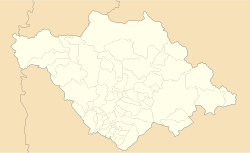
Zacatelco (Spanish pronunciation: [sakaˈtelko] ) is a city and municipal seat of the Zacatelco municipality located in the south of the Mexican state of Tlaxcala.[5] According to the 2010 population census conducted by the National Institute of Statistics and Geography, the city has a population of 38,466 people, it is the sixth most populous city in the state and is part of the Metropolitan area of Puebla. The city is also head of the third electoral district of Tlaxcala.[5]
The city was founded on December 1, 1529, by Agustín de Castañeda. In 1723 it is very important because it forms Zacatelco republic; this is achieved by joining the towns of San Juan, San Lorenzo, Santo Toribio, Santa Catarina, San Marcos and San Antonio, which depended on Tepeyanco. The most important historical figures of the city were the brothers Arenas, prominent revolutionaries. Domingo Arenas took the first land committee of Mexico in 1915, was one reason for coining the phrase battle: Zacatelco; the heart of south.
Zacatelco is located in the southern part of the valley of Tlaxcala, on the border with the state of Puebla, is at an altitude of 2,210 meters above sea level, making it one of the highest cities in Mexico. It is located just 11.9 km from the state capital, 27.1 km from the city of Puebla and 121.8 km from Mexico City.
- ^ "Principales resultados por localidad 2010 (ITER)" (in Spanish). Instituto Nacional de Estadística y Geografía. 2010. Retrieved 5 March 2011.
- ^ "Datos de proyecciones". CONAPO. Retrieved 26 July 2015.
- ^ "Indicadores de Desarrollo Humano y Género en México 2010" (PDF) (in Spanish). PNUD. Retrieved 12 June 2011.
- ^ Índice de Desarrollo Humano (idh). Retrieved 12 June 2011.
- ^ a b "ESTADO DE TLAXCALA". Enciclopedia de los Municipios de México. Instituto Nacional para el Federalismo y el Desarrollo Municipal. Archived from the original on 11 March 2007. Retrieved 4 January 2010.


