Back كروثورن ARZ Crowthorne (lungsod) CEB Crowthorne Welsh Crowthorne German Crowthorne English Crowthorne Spanish Crowthorne Basque کروتورن Persian Crowthorne French Crowthorne Irish
| Civil parish in Engeland | |||
|---|---|---|---|
| Situering | |||
| Regio | South East England | ||
| Graafschap | Berkshire | ||
| District | Bracknell Forest | ||
| Coördinaten | 51° 22' NB, 0° 48' WL | ||
| Algemeen | |||
| Oppervlakte | 13,0368 km² | ||
| Inwoners (2011) |
6902 (529 inw./km²) | ||
| Overig | |||
| Postcode(s) | RG45 | ||
| Netnummer(s) | 01344 | ||
| Grid code | SU841641 | ||
| Post town | CROWTHORNE | ||
| ONS-code | E04001142 | ||
| Website | www | ||
| Foto's | |||

| |||
| |||
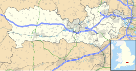
Crowthorne is een civil parish in het Engelse graafschap Berkshire. De stad ligt in het district Bracknell Forest en telt 6902 inwoners op 13 km².
