Back Norþælfheretūn ANG نورثالرتون AZB Northallerton (kapital sa kondado) CEB Northallerton Welsh Northallerton Danish Northallerton German Northallerton English Northallerton Spanish Northallerton Basque نورثالرتون Persian
| Civil parish in Engeland | |||
|---|---|---|---|
| Situering | |||
| Regio | Yorkshire and the Humber | ||
| Graafschap | North Yorkshire | ||
| District | Hambleton | ||
| Coördinaten | 54° 20' NB, 1° 26' WL | ||
| Algemeen | |||
| Oppervlakte | 14,7987 km² | ||
| Inwoners (2011) |
10655 (720 inw./km²) | ||
| Overig | |||
| Postcode(s) | DL6, DL7 | ||
| Netnummer(s) | 01609 | ||
| Grid code | SE371937 | ||
| Post town | NORTHALLERTON | ||
| ONS-code | E04007234 | ||
| Website | www | ||
| Foto's | |||

| |||
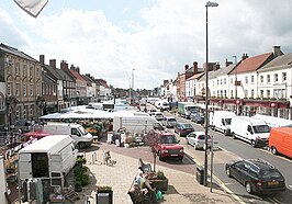
| Hoogstraat | |||
| |||
Northallerton is een town en civil parish in het bestuurlijke gebied Hambleton, in het Engelse graafschap North Yorkshire. De plaats telde in 2001 15.517 inwoners. Er wordt echter aangenomen dat dit aantal nu dichter bij de 25.000 ligt. De middelbare school van Northallerton is een van de oudste van Groot-Brittannië en dateert uit 1323.
-
All Saints, Northallerton
-
County Hall
-
Oorlogsmonument in Northallerton


